In this post, Matthew Simpson draws attention to sea-level rise projections for the Norwegian coastline and offers some thoughts on how Norwegian scenarios might contribute to – and benefit from – research in the OceanStates project.

What sea level information do we need to plan for the future? That’s a really big question. But it basically depends on who you are and where you are. When you think of Norway, sea-level rise is probably not the first thing that comes to mind! However, this is an issue for the country, and something we are already planning for. In this blog post I briefly explain what we understand about sea level in Norway and outline what we can learn from the OceanStates project (and vice versa).
The Norwegian coastline is very long, and very complicated. There are fjords, inlets, and thousands of islands. Much of the coast is steep and made up of rocks that are not easily eroded. However, there are also low lying areas where people live, there is economic activity like the fishing and petroleum industries, and important cultural buildings close to the shore. Norway’s cities are built on the coast and many have recently undergone significant developments along the shoreline. There is also a large network of roads and bridges that connect Norway’s coastal communities.

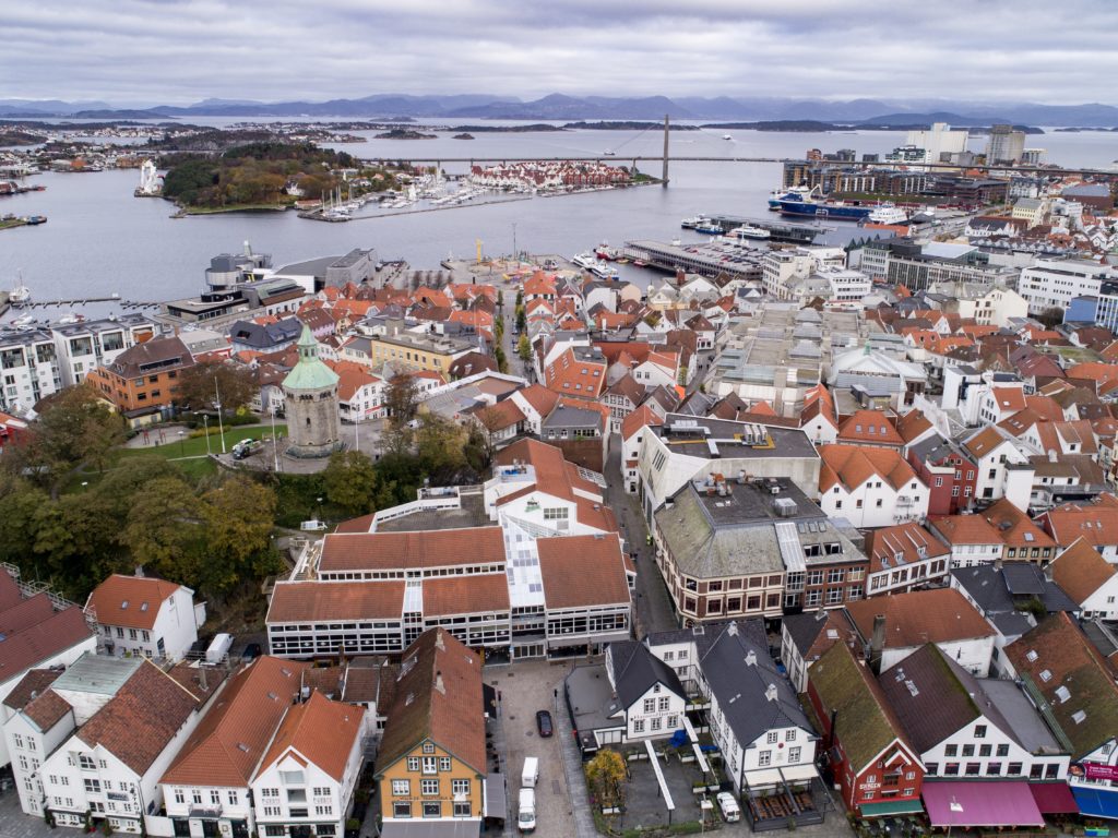
Fig. 1. Drone photo of the harbor area of Stavanger. Norway’s third largest city, population ~130,000. Used with permission from the City of Stavanger.
Around 10,000 years ago, the large ice sheet that covered Scandinavia melted and disappeared. The ice was a few kilometers thick in some places and its weight pushed down the Earth’s crust by several hundred meters. Although the ice melted thousands of years ago, the crust is still uplifting as the Earth continues to adjust. This process is known as postglacial rebound.
![]()
Measurements show that, in many areas of the coast, sea-level rise is now larger than postglacial rebound1. After thousands of years living with falling sea levels, the trend has reversed. And this means that sea levels are starting to encroach on Norway’s shores. The rise is being driven by warmer seas – which are expanding – and the melting of glaciers and the large ice sheets. Projections show that by the end of this century, sea level will have risen across the entire country2. The increase won’t be as large as other parts of the world, partly because of postglacial rebound, but Norway will still be dealing with rising seas in the future.

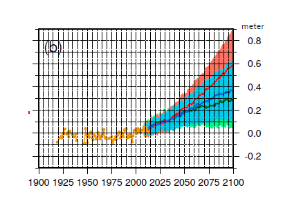
Fig. 2. Sea-level projections for Stavanger for the emission scenarios RCP2.6 (green), RCP4.5 (blue), and RCP8.5 (red). Annual mean tide gauge observations are shown in yellow. Adapted from Simpson et al., 2017.
What will be the consequences of these future changes? From the few studies available results suggest that the damage costs from sea-level rise could increase a lot. A recent European study found that annual damages in Norway will increase to between 1.7 and 5.9 percent of GDP by 21003. A remarkable finding; further investigation should test to see if that result is robust. A similar type of study that focused on the Norwegian city of Stavanger also found large increases in annual damages in the future – so much so that the city is now considering building a 32km seawall4. But more work is needed to better understand the implications of sea-level rise in Norway and how we make decisions on coastal management.

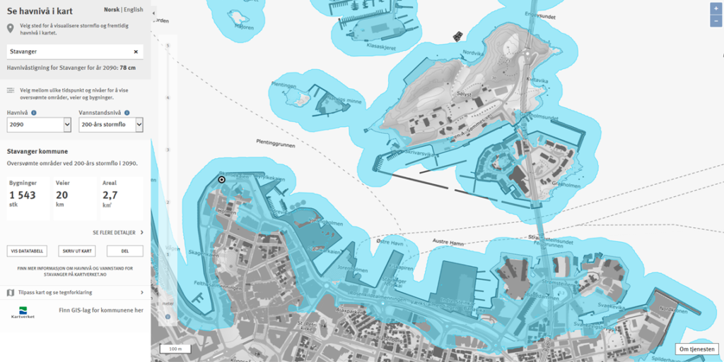
Fig. 3. Mapping potential future flooding events for Stavanger using a webtool developed by the Norwegian Mapping Authority. See https://www.kartverket.no/sehavniva/se-havniva-i-kart/
So what can Norway learn from the OceanStates project? And what can OceanStates learn from Norway? The key to answering that goes back to the original question at the beginning of this blog post – what sea level information do we need to plan for the future? There’s no straightforward answer, sea level information should be individually tailored depending on who and where you are. For example, the processes driving sea-level change can be different, timescales of interest may be different, and users of sea level information will have different needs (e.g. tolerance to uncertainty)5. Recognizing and understanding these differences helps generate discussion and is an important learning opportunity for anyone working with sea level! – so I look forward to both learning from and contributing to the OceanStates project.
![]()
References
- Breili, K., Simpson, M. J. R., and Nilsen, J. E. Ø. (2017). Observed Sea-Level Changes along the Norwegian Coast. Journal of Marine Science and Engineering, 5(29). doi: 10.3390/jmse5030029
- Simpson, M. J. R., Ravndal, O. R., Sande, H., Nilsen, J. E. Ø., Kierulf, H. P., Vestøl, O., and Steffen, H. (2017). Projected 21st Century Sea-Level Changes, Observed Sea Level Extremes, and Sea Level Allowances for Norway. Journal of Marine Science and Engineering, 5(36). doi: 10.3390/jmse5030036.
- Vousdoukas, M, I. et al. (2018) Climatic and socioeconomic controls of future coastal flood risk in Europe, Nature Climate Change, . doi:10.1038/s41558-018-0260-4
- https://www.nrk.no/norge/vurderer-a-bygge-mur-i-sjoen-for-a-unnga-oversvommelser-i-stavanger-1.14644000
- Hinkel, J., Church, J. A., Gregory, J. M., Lambert, E., Le Cozannet, G., Lowe, J., et al. (2019). Meeting user needs for sea level rise information: A decision analysis perspective. Earth’s Future, 7, 320–337. https://doi.org/10.1029/2018EF001071
 Matthew Simpson is a researcher at the Geodetic Institute of the Norwegian Mapping Authority. He has worked with different sea level problems for around 10 years and will be helping as an external expert to the OceanStates project.