In this blogpost, Ernst Nordtveit draws upon legal perspectives to discuss projections of sea level rise and reflect upon regional strategies in the Pacific that view maritime boundaries “not as ambulatory but as fixed borders”.
Written by Ernst Nordtveit

Rising sea levels because of global warming will lead to the inundation of coastal areas, the displacement of people, and the loss of valuable infrastructure and ecosystems. Sea level rise poses a specific existential risk to the low-lying island states in the Pacific, facing a situation where a significant part of or even the entire land area becomes uninhabitable because of erosion and saltwater intrusion, destroying ecosystems and vegetation and freshwater supply or even submerged by the sea. In addition to the direct damage, sea level rise might also have indirect legal consequences that will significantly impact many coastal states, particularly the island states in the Pacific, which risk losing large parts of the Exclusive Economic Zones (EEZ) and even their status as states. The question of what effect geographical change as a result of sea level rise might have on the maritime boundaries are thus an essential but complicated and disputed issue in international law.
The global sea level mean is projected to rise between approximately 40 and 80 cm by 2100, dependent on how much greenhouse gases are emitted, and to continue to rise for two millennia and stay elevated, even if the emission of greenhouse gases stopped today. It is also important to note that sea level rise is not uniform throughout the globe. Some areas will experience much higher rates of sea level rise than the others. It is still difficult to accurately project sea level rise on regional to local scales as many factors will influence it. Rising sea levels and more extreme weather might make some island and atoll states uninhabitable before the end of the century (IPCC AR6 2021).
If all or most of a state’s land area disappear or becomes uninhabitable, the question will be whether this affects the state’s existence. However, the most pressing issue is if the sea level rise will influence the extension of the EEZ granted to the coastal states by The United Nations Convention on the Law of the Sea (LOSC). In the EEZ, the coastal states have exclusive rights to natural resources in and on the continental shelf and in the water column above it. The EEZ covers a belt of 200 nautical miles from the “baselines” unless it meets the EEZ of a neighbouring state before that. The baseline is the line drawn between the outermost land, islands, or reef above sea level at low tide, the “low-water line”. For archipelagic states, straight baselines can be drawn between the outer islands and drying reefs of the archipelago covering all sea areas between the islands, provided that the ratio between the water and the land areas does not exceed 9 to 1 and the length of a straight baseline does not exceed 100 nautical miles (LOSC Article 47).
LOSC grants the small island states the exclusive right to valuable fishing resources and other marine resources in the sea areas within the baselines and a 200-mile belt outside the baselines, which grants them the exclusive right to the marine resources that have traditionally been the basis for their livelihood. The states in the Pacific have developed sophisticated systems for managing these resources, and their economy and livelihood today depend heavily on the resources in the EEZ. What, then, if islands in the archipelago’s outer part disappear due to rising sea levels? In that case, one pertinent question for these states is whether this will influence the baselines and, indirectly, the territorial sea borders and the EEZ. The loss of only one island might significantly impact the baseline if the boundaries are seen as ambulatory. This means it changes according to the geographical situation, which is the basis for defining the baselines.
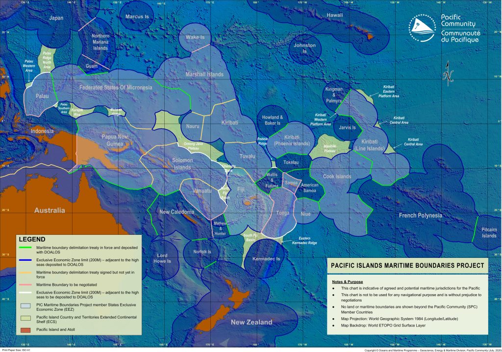
Maritime boundaries in the Pacific Islands region are still “work in progress”, but recording them and depositing them with the United Nations is a high-priority task for the island states. (Source: Pacific Community)
No general provision in LOSC expressly regulates whether or not an established baseline changes when changes in the sea levels alter the geographical situation that existed when the baseline was drawn. As it became evident in the 1990s that climate change would lead to substantial sea level change, a discussion of whether the baselines and maritime zone boundaries were ambulatory or fixed started in international legal literature. An article published by David D. Caron in 1990, “When Law Makes Climate Change Worse: Rethinking the Law of Baselines in Light of a Rising Sea Level,” became very influential. It concluded that boundaries were ambulatory in all cases where the LOSC did not expressly state the opposite. Caron, therefore, recommended a renegotiation of LOSC to remedy this fault.
Caron reached his view by ”negative implication”, which is based on the notion that if a provision in an act or a treaty gives a rule for one particular situation, one assumes that this rule does not apply to other situations. LOSC only mentions two situations where geographical changes do not affect the baselines or boundaries. This is where the baseline crosses a river delta (Article 7(2) and when there are changes in the geographical basis for the continental shelf outside the EEZ (Article 76(9). On this basis, Caron and his followers reasoned that the baseline in other cases would change according to the geographical changes caused by sea level rise. Therefore, the dominating view in legal literature for a long time was that it would be necessary to change the LOSC to establish fixed borders.
In recent years a different view has gained ground. Kate Purcell has presented a fundamental critique of the prevailing doctrine in her book Geographical Change and the Law of the Sea (published in 2019). She claims that the drafters of the LOSC were aware that there might be changes in shoreline by erosion and changes in sea level, even if the magnitude of the changes to be caused by climate change was unknown. In cases where the risk for changes in the shoreline was recognised, the rule was that the border should be fixed. This does not imply that the opposite rule should apply to all other situations. She emphasises the difference between rules that creates a right and rules that uphold a right. When a right is established based on the situation at the time, the need for stability becomes an essential consideration, even if the situation has changed in a manner that would lead to a different border based on the rule for how boundaries should be drawn. The consideration for stability and protection of the established legal position must be balanced against the considerations behind the rule and given considerable weight.
The International Law Commission 2018 included sea level rise in relation to international law in its long-term programme and subsequently established a study group to investigate different questions related to sea level rise. In a paper from the Study Group, presented at the Seventy-second session in Geneva in 2020, it is concluded that “to preserve legal stability, security, certainty and predictability, it is necessary to preserve existing maritime delimitations, either effected by agreement or by adjudication, notwithstanding the coastal changes produced by sea-level rise.” The study group also concluded that even if state praxis that fulfils the criteria for international customary law exists, it is not evident that an “opinion juris” in this direction is established and that more submissions in this respect are needed.
The Pacific Islands Forum has changed its view from a strategy where they demanded changes in LOSC to secure their maritime borders to expressing that their “maritime zones could not be challenged or reduced due to sea-level rise and climate change”. In their “Declaration on Preserving Maritime Zones in the Face of Climate Change-related Sea-Level Rise”, published in August 2021, the members of the Forum underline the role of LOSC as “an enduring legal order for the seas and oceans” and ”the principles of legal stability, security, certainty and predictability that underpin the Convention”, as well as ”the principles of equity, fairness and justice as critical legal principles also underpinning the Convention”. On this basis, the forum’s leaders proclaimed that their maritime zones, as established and notified to the Secretary-General of the UN, «shall continue to apply, without reduction, notwithstanding any physical changes connected to climate change-related sea-level rise».
It now is a growing acceptance for seeing maritime boundaries not as ambulatory but as fixed borders, at least as a point of departure. The consideration for stability, and the dramatic effect a change of boundaries will have for many low island states, is gaining more support as the most critical consideration. The LOSC does not contain a complete and satisfactory solution to these problems, and the interpretation of the provisions must be made on the basis that the drafting of the LOSC did not consider the issue at hand. Renegotiating LOSC will be a demanding exercise in the current international situation. The declarations from The Pacific Islands Forum will, if followed up by the individual states when the effects of sea level rise start to materialise, be considered a state practice that eventually will be accepted as the applicable law. The outer limits of the continental shelf will be permanent. This will also be the case even if the distance from the baselines should exceed 200 miles. One solution is to maintain the boundaries for the EEZ even if the baseline is changed.

Ernst Nordtveit is a professor at the Faculty of Law, University of Bergen, Norway, where he served as dean from 1999-2009. His teaching, research, and publishing is mainly within Natural Resource law, now focusing on Ocean and Climate law. He has published on the legal effects of geographical change as a result of Climate change in relation to boundaries and the right to natural resources.